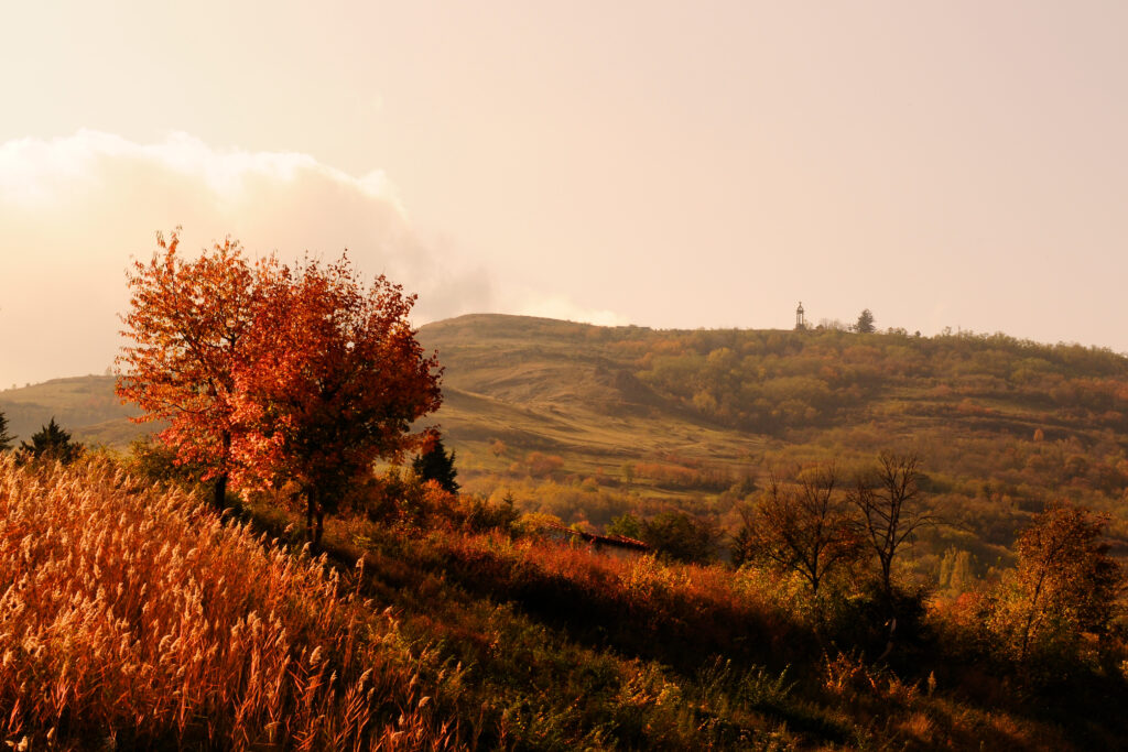
A remarkable plateau
Gergovia and its volcanoes
Before it took shape as the plateau we know today, Gergovia was formed by the superposition of four very ancient volcanoes. To better understand this exceptional geological formation, we have to go far back into the distant past. 35 million years ago, the Limagne Plain was covered by lakes that were the source of sedimentary deposits. 10 million years later, these lakes disappeared leaving their sedimentary deposits behind them.
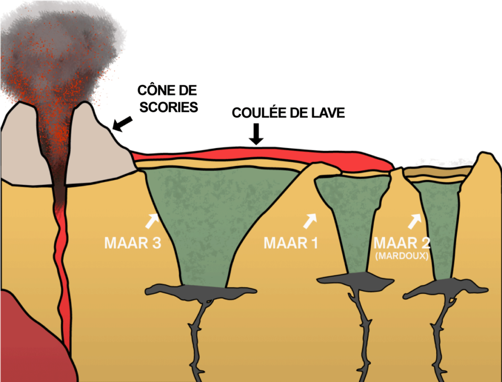
At this time, the plain was rocked by the start of an intense phase of volcanic activity. This mainly involved phreatomagmatic eruptions, which occur when magma rises to the surface and encounters the water of ancient lakes. These explosions form maars, i.e. craters that generally fill with water, forming lakes like Lac Pavin. In Gergovia, within the space of 5 million years, three maars formed next to each other and gradually filled with deep deposits.
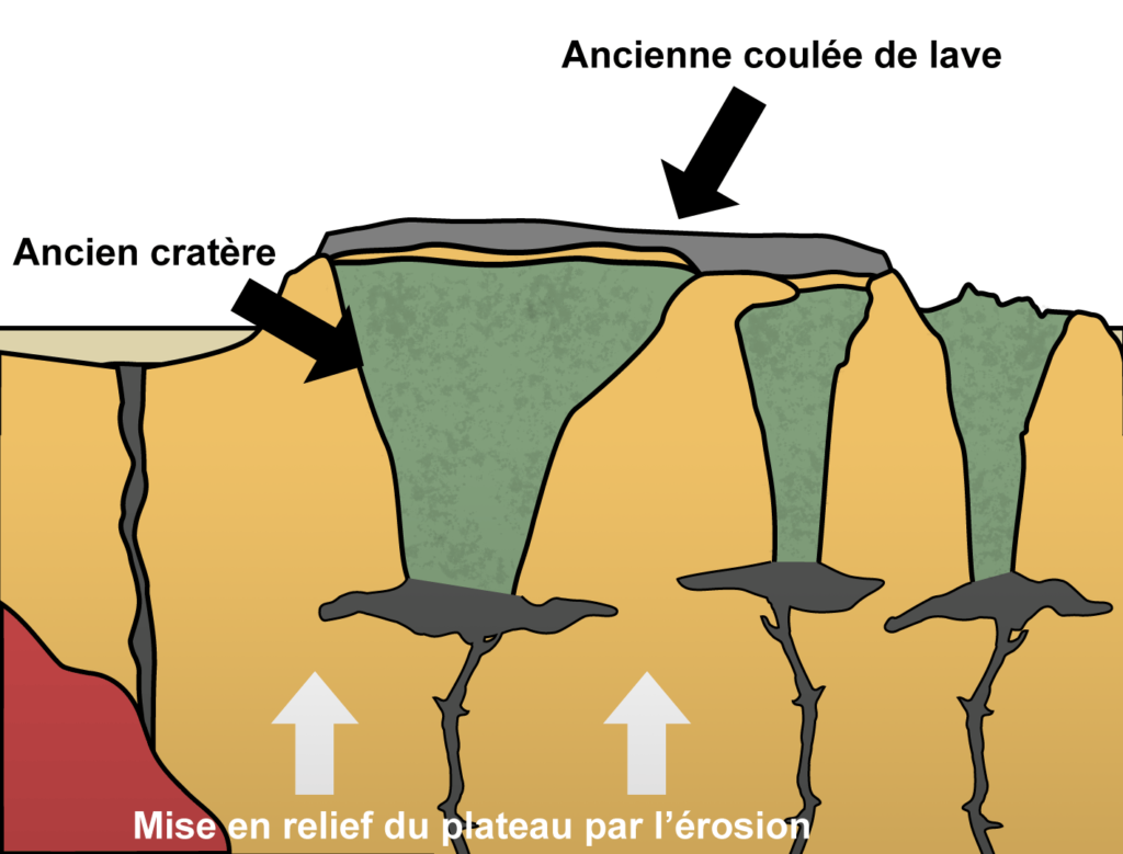
Lastly, 16 million years ago, a volcano erupted to the west of Gergovia, its lava flow partially covering the craters of two of the maars and part of the third. The lava gradually cooled, forming a basalt slab over 20 metres in height. This basalt shield protected the site against the erosive forces unleashed by the final phase of formation of the Alps, which raised the altitude of the basement. Everything protected by the slab resisted erosion, with the surrounding area gradually disappearing. This is an example of an inversion of relief.
Formation of the landscapes and geology of the Auvergne
The formation of the Gergovia Plateau is closely related to the Limagne Fault, the relief of which derives from the birth of the Alps driven by the collision of the Eurasian and African plates. These tectonic movements stretched the earth’s crust causing it to fracture, as with the Limagne Fault, and collapse, generating various types of contemporaneous volcanic activity.
The Gergovia Plateau formed during intense volcanic activity in the Limagne between 24 and 12 million years ago. Nearly three hundred volcanoes formed in this area, their craters subsequently being infilled by lava flows from nearby scoria cones (piles of magmatic rock fragments ejected by a volcanic eruption). Over time, these craters gradually lost their basalt shield, leaving behind the magnificent basalt plateaus that dominate the Allier plain today.
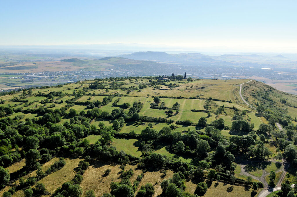
A magnificent panoramic viewpoint overlooking Auvergne
A key position in the Chaîne des Puys-Limagne Fault perimeter
A few million years later, this phenomenon of differential erosion resulted in the morphology of the current plateau, which presides over the magnificent Auvergne landscape:
- the high plateaus of Forez and Livradois to the east;
- the Chaîne des Puys to the west, whose highest point is the Puy de Dôme with an altitude of 1465 m;
- the massif of Monts Dore to the southwest, with the highest point of the Massif Central at 1886 m, the Puy de Sancy;
- the Cézallier plateau to the south;
- and of course the large number of volcanic structures that give the Limagne des Buttes its name.
A famous site
Among the many scenic viewpoints with remarkable silhouettes dotted around the Clermont-Ferrand area, Prosper Mérimée in the 19th century described the Gergovia Plateau as “a small mountain, flattened at its summit […] very steep on all sides”.
In 1861, a series of excavations on the plateau was commissioned by Napoleon III who was writing a history of Julius Caesar at the time and seeking information on the sites mentioned in Caesar’s text on the Gallic War. At the eastern end of the spur, where a monument celebrating the victory of Vercingetorix over the Romans was erected in 1900, a viewpoint opens up onto the site of the battle of Gergovia.
A natural area
Fauna and flora
The Gergovia Plateau is both a geological site of outstanding interest, and also a natural area rich in biodiversity. The plateau’s eastern flank is a listed Natura 2000 site, thus protecting the area’s highly diverse flora, which boasts around 300 different species of plant, including flowers (Euphorbia, Fetid Hellebore, Orchids, etc.), trees (Hawthorn, Ash, etc.), and characteristic dry grasslands (xeric species). Along with these plants, 111 species of butterfly have been listed, including the Great Peacock Moth, the largest butterfly in Europe. Many birds also visit or nest on the Gergovia Plateau, notably the harrier, the black kite and the common kestrel. The site is also home to other larger mammals such as foxes and wild boars.
Source : Association du site de Gergovie